
Beinecke Library is proud to call New Haven home. Please use the links below to see digitized files and detailed catalog records for many New Haven maps in the collections, along with some related maps in other area repositories at the end of the list:
New Haven in 1641 (reproduction of 1880)
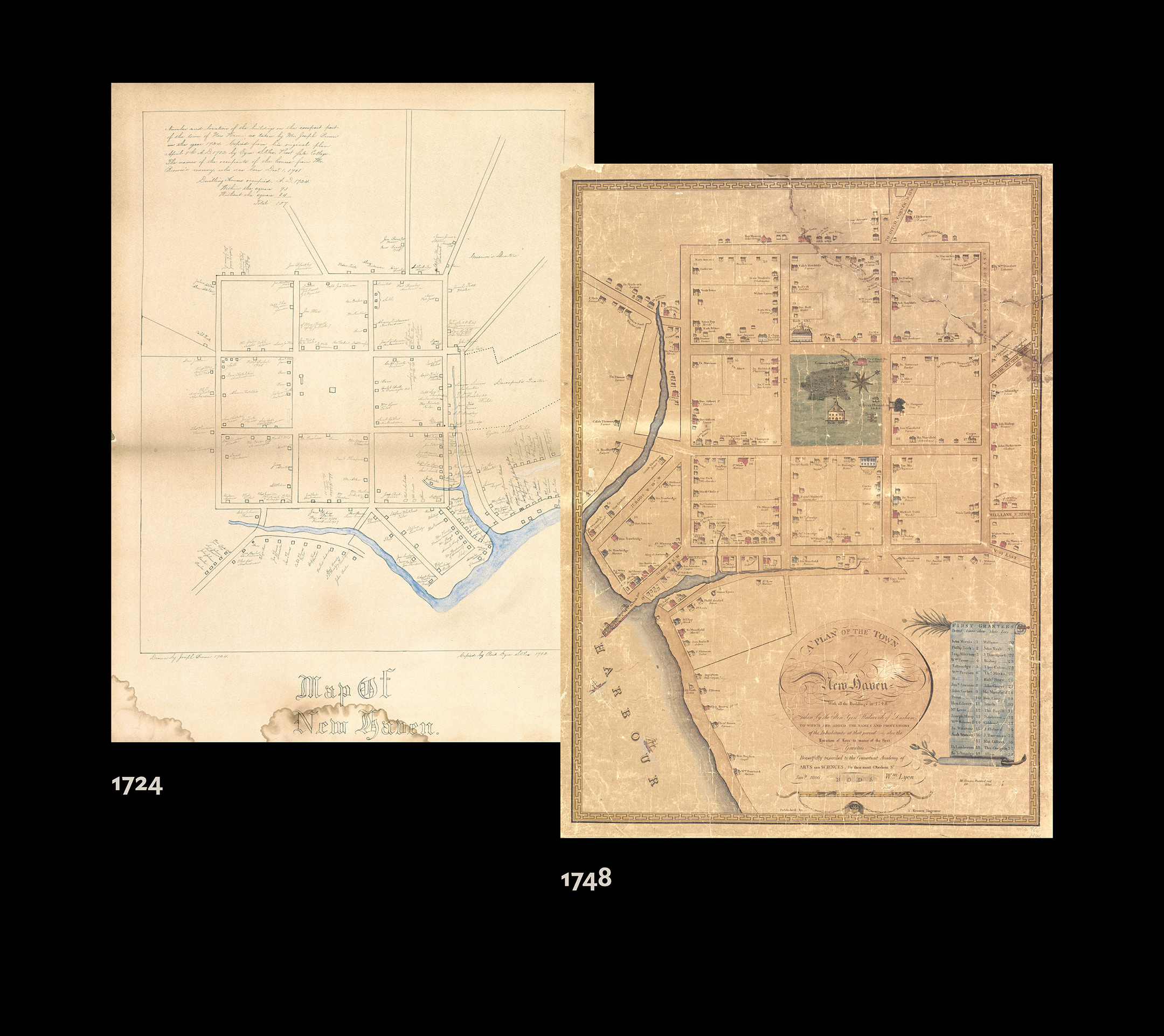
Map of New Haven / drawn by Joseph Brown, 1724 ; copied by Prest. Ezra Stiles, 1782
Plan of the city of New Haven taken in 1748 by James Wadsworth
Edition from 1880, digital file
A plan of New Haven and harbour / by President Stiles of Yale College, Sept. 27th, 1775.
Ezra Stiles Papers: Map of the invasion of New Haven, July 5, 1779
Plan of New Haven, 1812 / surveyed & published by A. Doolittle, Engraver, New Haven.
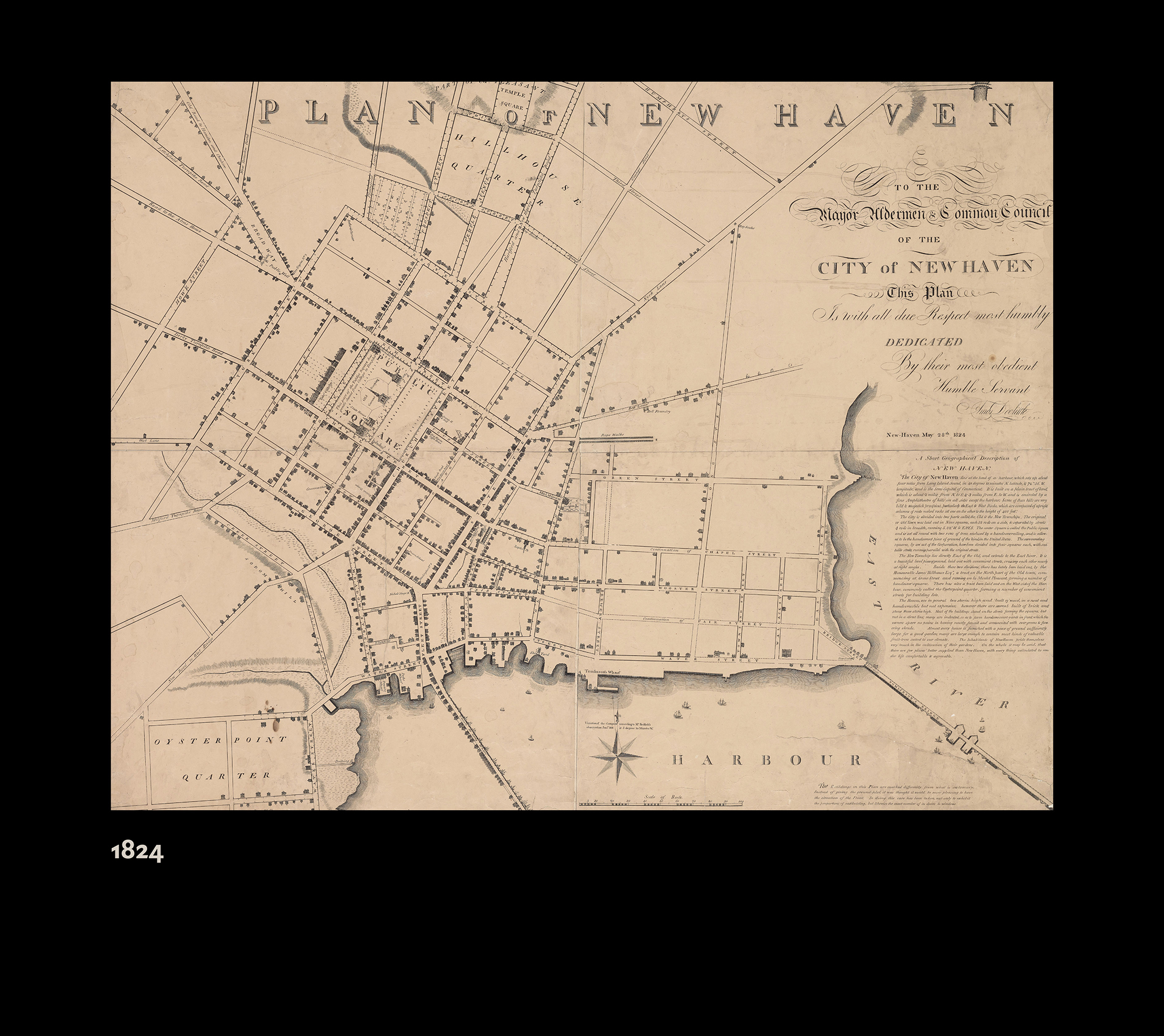
Plan of New Haven, 1824 / A. Doolittle, engraver
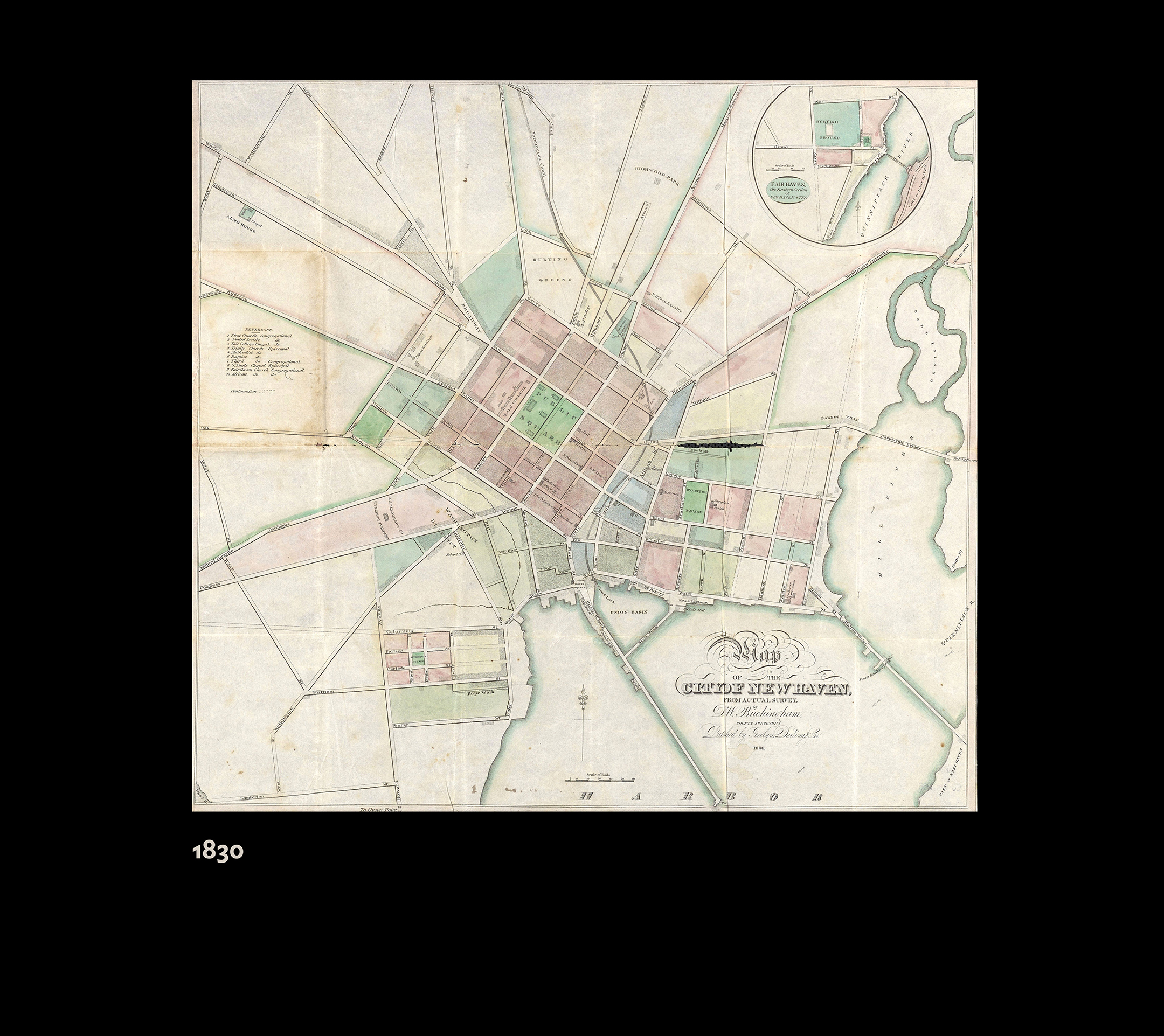
Map of the City of New Haven, 1830, from actual survey by D.W. Buckingham, county surveyor
Map of the city of New Haven, 1847
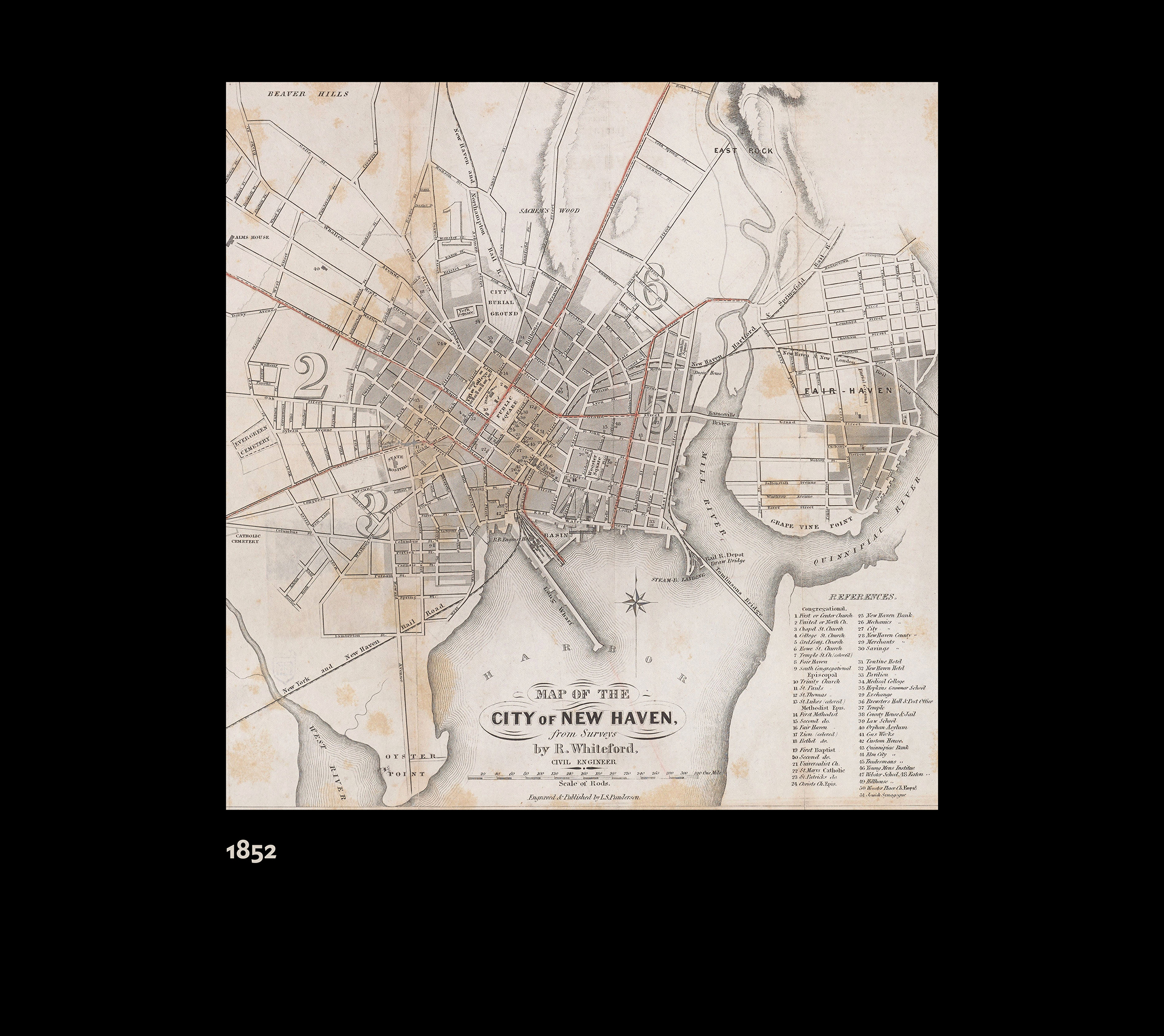
Map of the city of New Haven, 1852: from surveys / by R. Whiteford
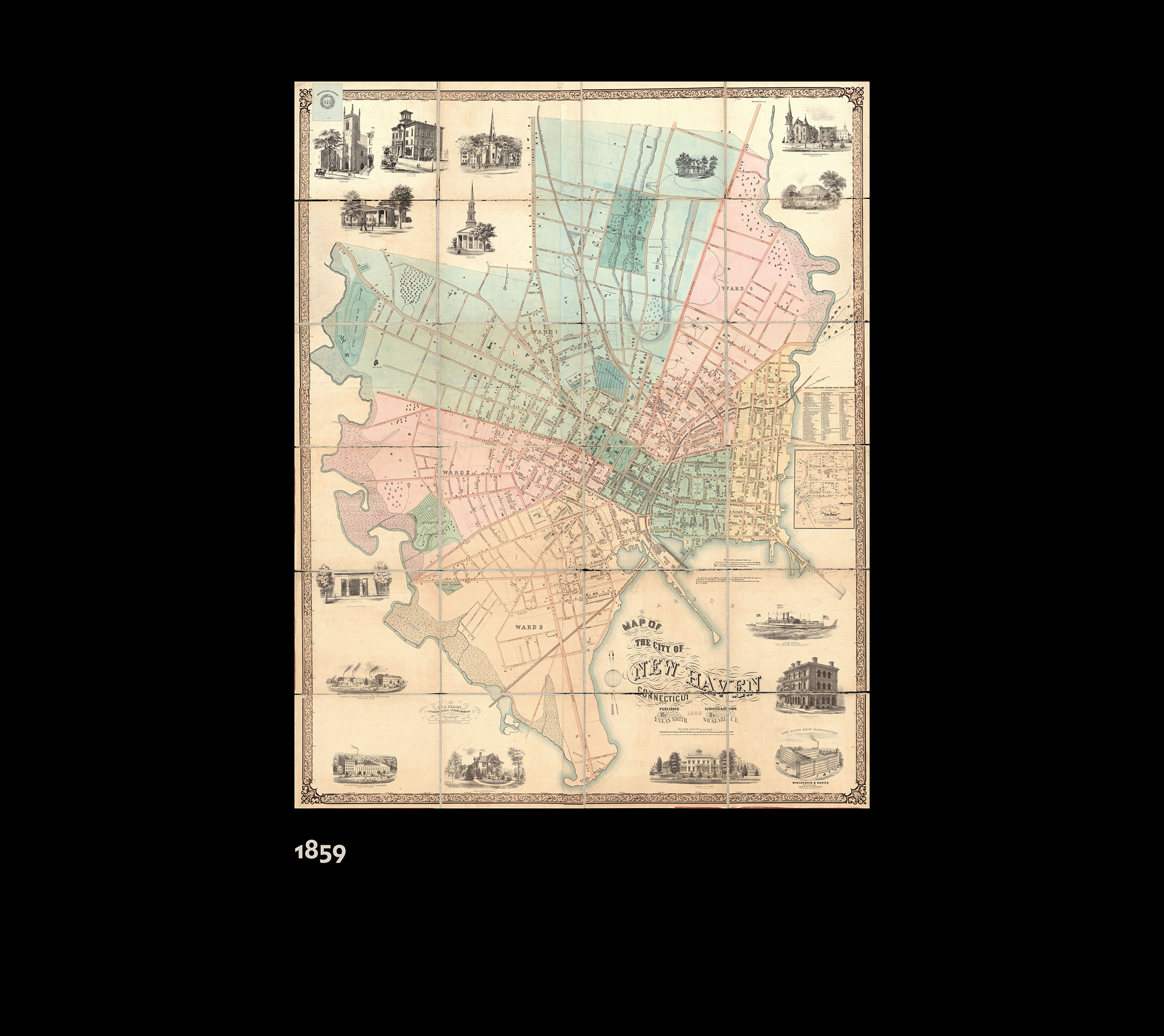
Map of the city of New Haven, Conn … 1859 … by S.W. Searle
Map of the New-Haven water survey. 1860
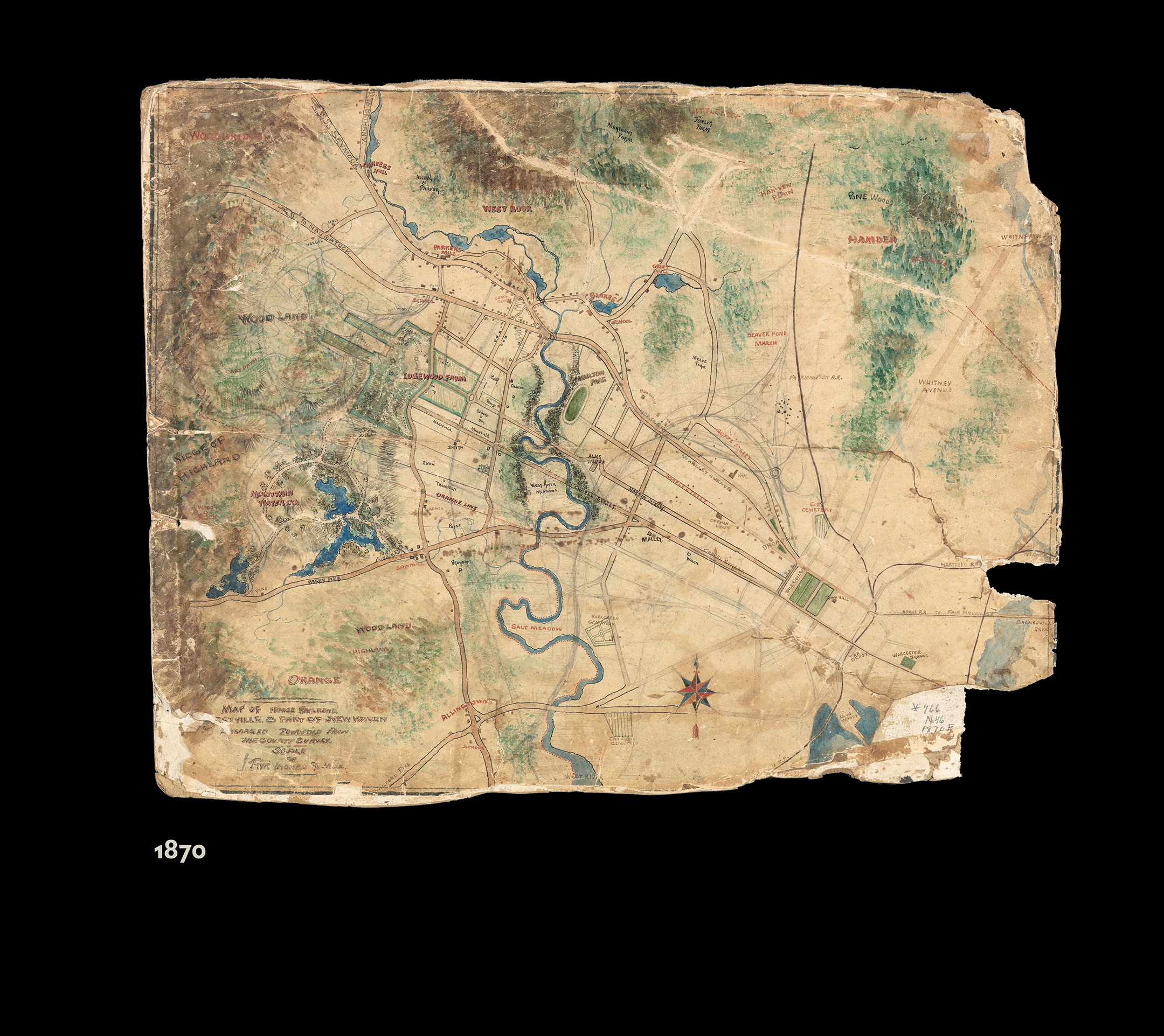
Plan of the city of New Haven, 1868
Plan of Fair Haven, New Haven Co., Conn. 1868
Benham’s new map of the city of New Haven, 1872 / drawn by Edward Lyman; from the records & surveys by S. Butler, civil engineer
Harbor of New Haven (1876)
City and vicinity of New Haven, Connecticut, derived wholly from the maps of the U.S. Coast Survey and of the City Engineer Department (1877)
Price, Lee & Co., 1878, new map of the city of New Haven / surveyed by S.W. Searle
The city of New Haven, Conn., 1879. [Bird’s eye view]
Insurance maps of New Haven, Connecticut. Sanborn Map Company, 1886
City of New Haven, Connecticut, 1893 / A.B. Hill, c.e.
Insurance maps of New Haven, Connecticut. Sanborn Map Company, 1901
Saloon map of New Haven, 1911
General plan of park system New Haven, Conn. (1915)
Oyster grounds in New Haven harbor, Towns of New Haven and Orange. 1916
The Price & Lee Co’s. map of the city of New Haven, Connecticut / prepared by A.B. Hill, Civil Engineer. (1917)
Insurance maps of New Haven, Connecticut. Sanborn Map Company, 1923-1924
Insurance maps of New Haven, Connecticut. Sanborn Map Company, 1973 (note: digital access limited to campus network due to copyright)
… and you may also be interested in other New Haven maps from other websites and collections, including:
Zoning and many other contemporary maps from the City of New Haven GIS
Historical Maps of the Grove Street Cemetery
Home Owners’ Loan Corporation Map, New Haven, CT 1937 (“redlining” map)
………………
The list and links above to local maps was first published to accompany a temporary exhibition of reproductions of seven New Haven maps on the ground floor glass windows of the west side of the library (facing High Street) that was on view from mid-June 2022 through July 24, 2024. This gallery shows the maps on the windows:
